
Wijchen
Wijchen | |
|---|---|
City and Municipality | |
 Wijchen castle | |
 Flag  Coat of arms | |
.svg) Location in Gelderland | |
| Coordinates: 51°48′N 5°44′E / 51.800°N 5.733°E | |
| Country | Netherlands |
| Province | Gelderland |
| Government | |
| • Body | Municipal council |
| • Mayor | Renske Helmer-Englebert (SP - Socialist Party) |
| Area | |
| • Total | 69.56 km2 (26.86 sq mi) |
| • Land | 66.18 km2 (25.55 sq mi) |
| • Water | 3.38 km2 (1.31 sq mi) |
| Elevation | 9 m (30 ft) |
| Population (January 2021)[4] | |
| • Total | 41,261 |
| • Density | 623/km2 (1,610/sq mi) |
| Demonym | Wijchenaar |
| Time zone | UTC+1 (CET) |
| • Summer (DST) | UTC+2 (CEST) |
| Postcode | 6600–6606, 6613–6617, 6634 |
| Area code | 024, 0486, 0487 |
| Website | www |

Wijchen (Dutch pronunciation: [ˈʋixə(n)] ⓘ) is a municipality and a town in the province of Gelderland, in the eastern part of the Netherlands.
Population centres
Number of residents per population centre per 12 December 2009:
| Wijchen | 32,904 |
| Alverna | 2,405 |
| Balgoij | 779 |
| Batenburg | 691 |
| Bergharen | 1,779 |
| Hernen | 820 |
| Leur | 130 |
| Niftrik | 570 |
Source: Statistics Netherlands[citation needed]
The population centre Woezik (3,820 residents on 1 January 2005) and the township Laak are statistically included in Wijchen.
Neighbourhoods
Neighbourhoods in Wijchen include:
- Centre: Kloosterakker
- Wijchen-Oost: Valendries, Oosterweg and Uilenboom.
- Woezik: Veenhof and Saltshof.
- Wijchen-Noord.
- Achterlo: Homberg, Heilige Stoel and Kraaijenberg.
- Wijchen-West: Blauwe Hof and Aalsburg.
- Wijchen-Zuid: Abersland, Diepvoorde, Huissteden, Hoogmeer, De Ververt, De Geer, Elsland, De Weertjes, De Grippen, Zesakkers, Zevendreef, Sluiskamp, Oudelaan, and Kronenland.
- Kerkeveld: De Gamert, De Meren, Diemenwei, De Flier, De Lingert.
- Huurlingsedam.
Streets in most neighbourhoods are numbered instead of named. This is not common practice in the Netherlands, therefore the street numbers are included in the house numbering. E.g. someone living in Abersland, 11th street, house #05 will usually use Abersland 1105 in his address.
Wijchen Castle (town hall)
Parts of Wijchen Castle (Kasteel Wijchen in Dutch) date from the 14th century, but it took its current Mannerist form in the years 1609–1629. It is surrounded by a moat and used to serve as the town hall. Currently, the town hall is down the road, while the castle is only used for important meetings.[5]
Notable residents


- Ine Lamers (born 1954) photographer and video installation artist
- Ronald van der Kemp (born 1964) fashion designer
- Arjen Thonen (born 1992) DJ and music producer better known as SWACQ[NL]
Sport
- Fred Rutten (born 1962) a football coach and a former footballer with 317 caps
- Ralf Elshof (born 1962) cyclist, competed at the 1984 Summer Olympics
- Roy Makaay (born 1975) football manager and former footballer with 526 caps
- Claudia van Thiel (born 1977) volleyball player, competed at the 1996 Summer Olympics
- Lieke Klaus (born 1989) BMX racer
- Joel Piroe (born 1999) footballer, Leeds United
Gallery
-
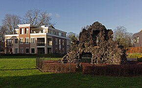 Wijchen, Lourdes cave near het Laantje
 -
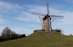 Wijchen, windmill: de Oude Molen
 -
 Wijchen, modern living appartements on the church square
 -
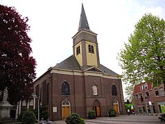 Wijchen, catholic church
 -
 Wijchen, Statue: Emilia van Nassau
 -
 Wijchen, sculpture: Zonneveld
 -
 Wijchen, sculpture: De Tafel
 -
 Wijchen, ceramic: The foot wants to go where you already find the eye
 -
 Batenburg, church: the Sint Victorkerk
 -
 Batenburg, ruins
 -
 Batenburg, windmill
 -
 Hernen, castle: kasteel Hernen
 -
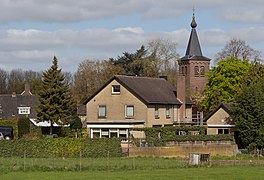 Niftrik, churchtower in the village


_church.JPG)
.JPG)
,_panorama_two_photos.jpg)
.JPG)


References
- ^ "Samenstelling college" [Members of the board] (in Dutch). Gemeente Wijchen. Retrieved 11 June 2014.
- ^ "Kerncijfers wijken en buurten 2020" [Key figures for neighbourhoods 2020]. StatLine (in Dutch). CBS. 24 July 2020. Retrieved 19 September 2020.
- ^ "Postcodetool for 6602DE". Actueel Hoogtebestand Nederland (in Dutch). Het Waterschapshuis. Retrieved 11 June 2014.
- ^ "Bevolkingsontwikkeling; regio per maand" [Population growth; regions per month]. CBS Statline (in Dutch). CBS. 1 January 2021. Retrieved 2 January 2022.
- ^ Stenvert, R. et al. (2000), Monumenten in Nederland: Gelderland, p. 332–333. Zwolle: Waanders Uitgevers. ISBN 90-400-9406-3.
External links
 Media related to Wijchen at Wikimedia Commons
- Official website
Places adjacent to Wijchen | |
|---|---|

| International | |
|---|---|
| National | |
| Geographic | |