
Riverside Drive (Los Angeles)
 | |
|---|---|
| Maintained by | Bureau of Street Services, City of L.A. DPW |
| Northwest end | Van Nuys Boulevard in Sherman Oaks |
| Major junctions | Coldwater Canyon Avenue in Studio City Laurel Canyon Blvd in Studio City Los Feliz Blvd. in Los Feliz |
| Southeast end | Figueroa Street & San Fernando Road in Cypress Park |
Riverside Drive is a northeast–southwest road connecting the San Fernando Valley and the Cypress Park neighborhood of the City of Los Angeles. It follows the course of the Los Angeles River.
Overview
Running approximately 20 miles (32 km) from Van Nuys Boulevard in Sherman Oaks to Figueroa Street and San Fernando Road In Cypress Park, it is one of the major thoroughfares in the San Fernando Valley. It runs through the heart of the Valley and is home to many of Southern California's major entertainment companies, passing both the Warner Bros. and Walt Disney Studios in Burbank. Then it enters West Glendale and continues as a major thoroughfare until it intersects with Victory Boulevard and Sonora Avenue. It then continues as the major thoroughfare through Griffith Park, though its name changes as it passes through the park, first to Zoo Drive, then Crystal Springs Drive, and then Griffith Park Drive, before becoming Riverside Drive again as it leaves the park at its southeastern boundary. Riverside Drive then continues east and south along the Los Angeles River, passing just north of the Silver Lake Reservoir. It runs along the northern edge of Elysian Park, passing north of Dodger Stadium before becoming Figueroa Street at a roundabout with San Fernando Road just north of the confluence of Arroyo Seco and the Los Angeles River.
Local transportation
Metro Local lines 96 and 155 operate on Riverside Drive.
Cities and communities
Listed west to east, or north to south
- Sherman Oaks
- Studio City
- Valley Village
- Toluca Lake
- Burbank
- Glendale
- Silver Lake
- Los Feliz
- Elysian Park
Notable places
Listed west to east, or north to south
- Los Angeles River[1]
- Westfield Fashion Square, Sherman Oaks, California[2]
- Notre Dame High School, Sherman Oaks, California[3]
- North Hollywood Medical Center, North Hollywood, California, a former hospital used for the filming of the Scrubs TV series for its first eight seasons
- Oldest remaining Bob's Big Boy Restaurant
- Providence High School, Burbank, California[4]
- Forest Lawn Memorial Park (nearby)[5]
- Disney Channel Headquarters, Burbank, California
Disney Channel Headquarters - Warner Bros. Studios, Burbank, California[6]
- Warner Records, Burbank, California
- Walt Disney Studios, Burbank, California[7]
- ABC Studios, Burbank, California
- Walt Disney Animation Studios, Burbank, California[8]
- Equidome
- Los Angeles Equestrian Center[9]
- Los Angeles Zoo (Zoo Drive)[10]
- Autry National Center (Zoo Drive)[11]
- Griffith Park (Griffith Park Drive)
- Griffith Observatory (nearby)[12]
- Silver Lake Reservoir (nearby)[13]
- Elysian Park, Los Angeles, California[14]
- Dodger Stadium (nearby)[15]

Gallery
-
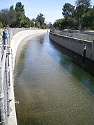 Adjacent Los Angeles River in Sherman Oaks
 -
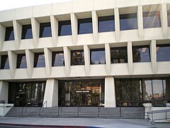 Sunkist Building, Sherman Oaks
 -
 Westfield Fashion Square in Sherman Oaks
 -
 Notre Dame High School, Sherman Oaks
 -
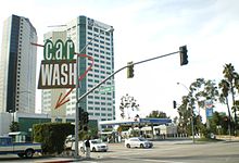
 Bob's Big Boy in Burbank
 -
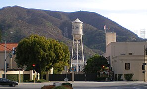
 Burbank media district
 -
 Warner Bros. Studios, Burbank
 -
 ABC Studios
 -
 Disney Animation Building, Burbank
 -
 Los Angeles Equestrian Center
 -
 Riverside-Zoo Drive Bridge
 -
 Los Angeles Zoo
 -
 Autry National Center
 -
 Griffith Observatory
 -
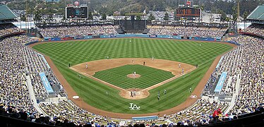 Dodger Stadium
 -
 Elysian Park, looking south from Riverside Drive


Sport
The drive hosted part of the 50 km walk athletic event near Griffith Park for the 1932 Summer Olympics.[16]
See also
- Harbor Boulevard, a street in Orange County that contains Disneyland.
References
- ^ "Los Angeles River Tour". Archived from the original on 2007-10-16.
- ^ "Westfield Fashion Square".
- ^ "Notre Dame High School".
- ^ "Providence High School".
- ^ "Forest Lawn Memorial Park: Hollywood Hills". Archived from the original on 2012-07-31.
- ^ "Warner Bros. Studios Facilities".
- ^ "The Walt Disney Studios".
- ^ "Walt Disney Animation Studios".
- ^ "Los Angeles Equestrian Center". Archived from the original on 2008-02-22.
- ^ "Los Angeles Zoo".
- ^ "Autry National Center".
- ^ "Griffith Park Observatory".
- ^ "About the Silver Lake Community".
- ^ "Elysian Park".
- ^ "The Official Site of the Los Angeles Dodgers: Dodger Stadium Ballpark".
- ^ 1932 Summer Olympics official report. p. 86.
Riverside Drive (Los Angeles).
| Districts and neighborhoods | |||||||||||||||||||||||||||||||||
|---|---|---|---|---|---|---|---|---|---|---|---|---|---|---|---|---|---|---|---|---|---|---|---|---|---|---|---|---|---|---|---|---|---|
| Points of interest |
| ||||||||||||||||||||||||||||||||
| Transportation |
| ||||||||||||||||||||||||||||||||
| Neighboring cities | |||||||||||||||||||||||||||||||||
