
File:Spain Galicia location map.svg

Size of this PNG preview of this SVG file: 512 × 553 pixels. Other resolutions: 222 × 240 pixels | 444 × 480 pixels | 711 × 768 pixels | 948 × 1,024 pixels | 1,896 × 2,048 pixels.
Original file (SVG file, nominally 512 × 553 pixels, file size: 576 KB)
| This is a file from the Wikimedia Commons. Information from its description page there is shown below. Commons is a freely licensed media file repository. You can help. |
Summary
| Description |
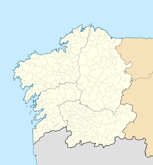
English: Location map of Galicia (Spain)
Equirectangular projection, N/S stretching 130 %. Geographic limits of the map:
Español: Mapa de localización de la comunidad autónoma de Galicia (España)
Proyección equirrectangular, N/S estirada 130 %. Límites geográficos del mapa:
|
|
| Date | ||
| Source | Own work based on: EspañaLoc.svg by HansenBCN | |
| Author | Miguillen | |
| SVG development | This locator map was created with Inkscape.
|
Licensing
Miguillen, the copyright holder of this work, hereby publishes it under the following license:
This file is licensed under the Creative Commons Attribution-Share Alike 3.0 Unported license.
Attribution: Miguillen
- You are free:
- to share – to copy, distribute and transmit the work
- to remix – to adapt the work
- Under the following conditions:
- attribution – You must give appropriate credit, provide a link to the license, and indicate if changes were made. You may do so in any reasonable manner, but not in any way that suggests the licensor endorses you or your use.
- share alike – If you remix, transform, or build upon the material, you must distribute your contributions under the same or compatible license as the original.
File history
Click on a date/time to view the file as it appeared at that time.
| Date/Time | Thumbnail | Dimensions | User | Comment | |
|---|---|---|---|---|---|
| current | 21:49, 19 October 2016 | | 512 × 553 (576 KB) | HombreDHojalata | [http://www.xunta.es/dog/Publicados/2013/20130607/AnuncioG0244-060613-0003_gl.html DECRETO 83/2013, do 6 de xuño, polo que se aproba a fusión voluntaria dos municipios de Oza dos Ríos e Cesuras e se constitúe o municipio de Oza-Cesuras] DOG, 7 de x... |
| 21:33, 19 October 2016 |  | 512 × 553 (576 KB) | HombreDHojalata | [http://www.xunta.gal/dog/Publicados/2016/20161017/AnuncioG0244-131016-0001_gl.html DECRETO 134/2016, do 22 de setembro, polo que se aproba a fusión voluntaria dos municipios de Cerdedo e Cotobade e se constitúe o municipio de Cerdedo-Cotobade], DOG... | |
| 18:32, 20 May 2010 |  | 512 × 553 (551 KB) | Miguillen | color mar | |
| 15:28, 20 May 2010 |  | 512 × 553 (551 KB) | Miguillen | == {{int:filedesc}} == {{Information |Description={{en|Location map of Galicia (Spain)}} Equirectangular projection, N/S stretching 130 %. Geographic limits of the map: * N: 43.055249° N * S: 39.750129° N * W: 2.282836° O * E: 0. |
File usage
The following pages on the English Wikipedia use this file (pages on other projects are not listed):
- 1987–88 Primera División B de Baloncesto
- 1992 Summer Olympics torch relay
- 2013–14 Tercera División
- 2014–15 Tercera División
- 2015–16 Tercera División
- 2016–17 Tercera División
- 2017–18 Tercera División
- 2018–19 Tercera División
- 2019–20 Tercera División
- 2020–21 Tercera División
- 2021–22 Tercera División RFEF
- 2022 Primera División RFEF play-offs
- 2022–23 Tercera Federación
- 2023–24 Tercera Federación
- A Cañiza
- A Coruña
- A Coruña Airport
- A Laracha
- Antas de Ulla
- Baixa Limia – Serra do Xurés
- Baleira
- Barbadás
- Betanzos
- Bóveda
- Calvos de Randín
- Camariñas
- Cando, Spain
- Castiñeiras Lake
- Castle of Soutomaior
- Cerdedo-Cotobade
- Cortegada Island
- English Armada
- Enquerentes
- Espasante
- Ferrol, Spain
- Fornelos de Montes
- Galician derby
- Lake As Pontes
- Mondoñedo
- Monte Aloia
- Mount Pindo
- Nigrán
- O Carballiño
- Ortigueira
- Primera División de Baloncesto
- Redondela
- Ria of Ferrol
- Ribadeo
- River Cabe
- Rock of the Three Kingdoms
- San Cristovo de Cea
- Santiago de Compostela
- Santiago de Compostela Cathedral
- Santiago–Rosalía de Castro Airport
- Sobroso Castle
- Sálvora
- Tower of Hercules
- University Museum A Domus do Mitreo
- Valga, Pontevedra
- Vigo
- Vigo–Peinador Airport
- Viveiro
- User:Michael!/Project:Location map templates/Spain
- User:PotatoNerd/sandbox
- Module:Location map/data/Spain Galicia
- Module:Location map/data/Spain Galicia/doc
Global file usage
The following other wikis use this file:
- Usage on ar.wikipedia.org
- Usage on ast.wikipedia.org
- Usage on az.wikipedia.org
- Usage on ba.wikipedia.org
- Usage on be.wikipedia.org
- Usage on bg.wikipedia.org
- Usage on ca.wikipedia.org
- Usage on ceb.wikipedia.org
- Usage on cs.wikipedia.org
- Usage on de.wikipedia.org
View more global usage of this file.