
File:Reliefkarte Portugal.png

Size of this preview: 312 × 599 pixels. Other resolutions: 125 × 240 pixels | 250 × 480 pixels | 400 × 768 pixels | 533 × 1,024 pixels | 1,633 × 3,133 pixels.
Original file (1,633 × 3,133 pixels, file size: 6.87 MB, MIME type: image/png)
| This is a file from the Wikimedia Commons. Information from its description page there is shown below. Commons is a freely licensed media file repository. You can help. |
Summary
| Description |
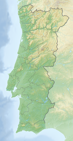
Deutsch: Reliefkarte Portugal
Topographischer Hintergrund: NASA Shuttle Radar Topography Mission (public domain). SRTM3 v.2. |
||||||||
| Date | |||||||||
| Source | Own work | ||||||||
| Author | Tschubby | ||||||||
| Permission (Reusing this file) |
I, the copyright holder of this work, hereby publish it under the following licenses:
This file is licensed under the Creative Commons Attribution-Share Alike 2.5 Generic, 2.0 Generic and 1.0 Generic license.
You may select the license of your choice. |

File history
Click on a date/time to view the file as it appeared at that time.
| Date/Time | Thumbnail | Dimensions | User | Comment | |
|---|---|---|---|---|---|
| current | 14:52, 12 March 2020 | | 1,633 × 3,133 (6.87 MB) | Tschubby | {{Information |description= |date= |source= |author= |permission= |other versions= }} |
| 17:31, 4 May 2018 |  | 1,633 × 3,132 (7.19 MB) | Tschubby | == {{int:filedesc}} == {{Information |Description= {{de| Reliefkarte Portugal}} Topographischer Hintergrund: [http://www2.jpl.nasa.gov/srtm NASA Shuttle Radar Topography Mission] (public domain). SRTM3 v.2. |Source={{own}} |Date= 2018-05-04 |Author= Tschubby |Permission= {{self|GFDL|Cc-by-sa-3.0-migrated|Cc-by-sa-2.5,2.0,1.0}} |other_versions= }} Category:Topographic maps of Portugal Category:Location maps of Portugal |
File usage
More than 100 pages use this file. The following list shows the first 100 pages that use this file only. A full list is available.
- 1531 Lisbon earthquake
- 1531 in Portugal
- 2005 WGC-World Cup
- Aguieira Dam
- Alcantarilha River
- Alcoa River
- Alcobaça Formation
- Alqueva Dam
- Alto Lindoso Dam
- Alto Rabagão Dam
- Alto River
- Alvão Natural Park
- Atlantic Open
- Battle of Braga (1809)
- Battle of Bussaco
- Battle of Fuentes de Oñoro
- Battle of Grijó
- Battle of Redinha
- Battle of Roliça
- Battle of Sabugal
- Battle of Vimeiro
- Battle of the Lines of Elvas
- Battle of Évora (1808)
- Belver Dam
- Bemposta Dam
- Boquilobo Bog Natural Reserve
- Bouçã Dam
- Cabo Carvoeiro
- Cabo da Roca
- Cabo de Santa Maria (Faro)
- Cabril Dam
- Calcários Micríticos da Serra de Aire
- Caniçada Dam
- Cape Espichel
- Cape Santo André
- Cape St. Vincent
- Caranguejeira Conglomerate
- Carrapatelo Dam
- Castro Marim and Vila Real de Santo António Marsh Natural Reserve
- Corno do Bico Protected Landscape
- Crestuma–Lever Dam
- Douro DOC
- Elvas
- English Armada
- Estoril Challenge
- Estoril Open (golf)
- Fortress of Segura
- Fratel Dam
- Invasion of Portugal (1807)
- Lagoa da Pedreira
- Lagoa de Óbidos
- Lima River
- Lines of Torres Vedras
- Lisbon
- List of hydroelectric power stations in Portugal
- Miranda Dam
- Montejunto Formation
- Montesinho Natural Park
- Museu da Marioneta
- NATO Integrated Air Defense System
- National Museum of Archaeology, Lisbon
- National Museum of Contemporary Art of Chiado
- National Museum of Costume (Portugal)
- National Museum of Ethnology (Portugal)
- Northern Littoral Natural Park
- Open de Portugal
- Papo Seco Formation
- Pego do Inferno
- Peninsular War
- Picote Dam
- Pocinho Dam
- Portugal Masters
- Pracana Dam
- Rafael Bordalo Pinheiro Museum
- Raiva Dam
- Ria de Aveiro
- Rock of the Three Kingdoms
- Régua Dam
- Salamonde Dam
- Santa Luzia Dam
- Second Battle of Porto
- Serra da Boa Viagem
- Serra da Estrela
- Serra da Estrela Natural Park
- Serra da Malcata Nature Reserve
- Serra da Marofa
- Serra de Monchique
- Serra de Montejunto Protected Landscape
- Serra de São Mamede
- Serra de São Mamede Natural Park
- Serra do Alvão
- Serra do Buçaco
- Serra do Marão
- Serras de Aire e Candeeiros Natural Park
- Siege of Almeida (1810)
- Siege of Chaves
- Torre (Serra da Estrela)
- Torre River, Portugal
- Touvedo Dam
- Valeira Dam
View more links to this file.
Global file usage
The following other wikis use this file:
- Usage on bg.wikipedia.org
- Саброза
- Лисабон
- Порто
- Томар
- Порталегре
- Сакавен
- Ещорил
- Кашкайш
- Фатима (град)
- Овар
- Коимбра
- Гимараеш
- Трофа, Сегадайнш и Ламаш ду Вога
- Лейрия
- Треишедо
- Шаблон:ПК Португалия
- Порту Кову
- Авейро
- Тавира
- Фару
- Брага
- Вила Нова ди Гая
- Амадора
- Браганса
- Сетубал
- Вашку да Гама (мост)
- Сау Жуау ди Негрилюш
- Каминя
- Одимира
- Лоузан
- Матузинюш
- Леишоиш
- Монтижу
- Алкуентри
- Манастир на Баталя
- Кинта ду Анжу
- Кащру Верди
- Бежа
- Форнуш ди Алгодриш
- Повуа ди Варшин
- Барселуш
- Зезери
- Мондегу
- Сиера да Ищрела
- Фонти Лонга
- Санта Мария да Фейра
- Синтра
- Usage on ca.wikipedia.org
- Usage on da.wikipedia.org
View more global usage of this file.