
File:Mediterranean at 218 BC-en.svg

Size of this PNG preview of this SVG file: 800 × 475 pixels. Other resolutions: 320 × 190 pixels | 640 × 380 pixels | 1,024 × 608 pixels | 1,280 × 759 pixels | 2,560 × 1,519 pixels | 2,058 × 1,221 pixels.
Original file (SVG file, nominally 2,058 × 1,221 pixels, file size: 435 KB)
| This is a file from the Wikimedia Commons. Information from its description page there is shown below. Commons is a freely licensed media file repository. You can help. |
Summary
| Description |
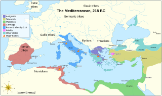
English: Mediterranean at 218 BC
|
||||||||||||||
| Date | |||||||||||||||
| Source |
Own work based on:
|
||||||||||||||
| Author | Goran tek-en | ||||||||||||||
| Permission (Reusing this file) |
This file is licensed under the Creative Commons Attribution-Share Alike 4.0 International license. Attribution: Goran tek-en
|
||||||||||||||
| Other versions |
[]
|
||||||||||||||
| SVG development | This vector image was created with Inkscape. |
||||||||||||||


| Object location | | View this and other nearby images on: OpenStreetMap |
|---|


File history
Click on a date/time to view the file as it appeared at that time.
| Date/Time | Thumbnail | Dimensions | User | Comment | |
|---|---|---|---|---|---|
| current | 19:33, 5 December 2021 | | 2,058 × 1,221 (435 KB) | Goran tek-en | ppi to 96, optimized |
| 13:26, 14 December 2019 |  | 2,058 × 1,221 (461 KB) | Macesito | The Balearic Islands were not part or a colony of Carthage | |
| 18:17, 6 August 2018 |  | 2,058 × 1,221 (433 KB) | Goran tek-en | Bosporen corrected | |
| 19:20, 15 December 2014 |  | 2,058 × 1,221 (610 KB) | Goran tek-en | User created page with UploadWizard |
File usage
The following pages on the English Wikipedia use this file (pages on other projects are not listed):
Global file usage
The following other wikis use this file:
- Usage on ar.wikipedia.org
- Usage on azb.wikipedia.org
- Usage on be.wikipedia.org
- Usage on bg.wikipedia.org
- Usage on ca.wikipedia.org
- Usage on cs.wikipedia.org
- Usage on cy.wikipedia.org
- Usage on de.wikipedia.org
- Usage on el.wikipedia.org
- Usage on et.wikipedia.org
- Usage on fa.wikipedia.org
- Usage on fr.wikipedia.org
- Usage on he.wikipedia.org
- Usage on ia.wikipedia.org
- Usage on id.wikipedia.org
- Usage on it.wikipedia.org
- Usage on ja.wikipedia.org
- Usage on kab.wikipedia.org
- Usage on ka.wikipedia.org
- Usage on ko.wikipedia.org
- Usage on nl.wikipedia.org
- Usage on no.wikipedia.org
- Usage on pl.wikipedia.org
- Usage on ro.wikipedia.org
- Usage on ru.wikipedia.org
View more global usage of this file.