
Search results
There is a page named "File:Boko Haram insurgency map.png" on Wikipedia
 File:Boko Haram insurgency map.svg is a vector version of this file. It should be used in place of this PNG file. File:Boko Haram insurgency map.png → File:Boko...(1,600 × 1,231 (395 KB)) - 03:01, 5 December 2023
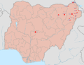
 English Map of the Boko Haram assault on Baga, 3 Jan 2015 applies to jurisdiction: United States of America determination method: work of the federal...(962 × 721 (136 KB)) - 09:11, 20 August 2024
 Commons Attribution-Share Alike 4.0 truetrue English Map of the southern Chad Basin showing insurgent control author name string: Borysk5 Wikimedia username:...(1,153 × 1,048 (1.01 MB)) - 02:15, 1 November 2022
 English Map of a Nigerian assault in Sambisa forest, on 16 May 2015 applies to jurisdiction: United States of America determination method: work of the...(968 × 724 (321 KB)) - 09:11, 20 August 2024
 English Map of the raid on Chibok Girls Secondary School applies to jurisdiction: United States of America determination method: work of the federal government...(871 × 713 (152 KB)) - 09:11, 20 August 2024
 DescriptionBoko Haram Insurgency in Lake Chad Region (Feb. 11, 2015).png English: This map depicts the areas controlled and attacked by Boko Haram in the...(3,075 × 3,500 (4.49 MB)) - 03:01, 5 December 2023
 (55041 bytes) Created from image in public domain [[Image:Mexico_states_map_small.png]]. Released into public domain. Image highlights states in which the...(442 × 306 (51 KB)) - 04:03, 11 July 2023
 fact that the Iraq War itself is over, and there is a post insurgency, and that insurgency, bei 2011-12-20 19:01 Kermanshahi 1480×628× (56964 bytes) 2011-12-20...(1,480 × 740 (58 KB)) - 23:47, 10 July 2023
 (Intercommunal conflict) Mozambique Insurgency in Cabo Delgado Nigeria (Boko Haram Islamists) Nigeria (South Nigeria insurgency) Senegal Casamance conflict See...(4,509 × 3,449 (1.74 MB)) - 07:54, 17 November 2023
 Selected maps are included in the Wikimedia Atlas of Syria. See also : Category:Conflicts by country I, the copyright holder of this work, hereby publish...(3,360 × 3,436 (821 KB)) - 02:14, 4 December 2023
 DescriptionBokoHaraminsurgency.png Map of Boko Haram insurgency in June 2022 Date 13 June 2022 Source Own work. Insurgent controlled areas are based on...(1,848 × 2,021 (332 KB)) - 03:01, 5 December 2023
 Selected maps are included in the Wikimedia Atlas of Egypt. See also : Category:Conflicts by country The original description page was here. All following...(327 × 350 (30 KB)) - 13:33, 18 August 2024
 (Intercommunal conflict) Mozambique Insurgency in Cabo Delgado Nigeria (Boko Haram Islamists) Nigeria (South Nigeria insurgency) Senegal Casamance conflict See...(1,748 × 2,012 (246 KB)) - 12:59, 10 October 2023
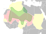 holder of this work, hereby publish it under the following license: English Map of Al-Qaeda in the Islamic Maghreb (AQIM) activities French Carte de l'activité...(468 × 344 (132 KB)) - 23:43, 6 May 2024
 (Intercommunal conflict) Mozambique Insurgency in Cabo Delgado Nigeria (Boko Haram Islamists) Nigeria (South Nigeria insurgency) Senegal Casamance conflict See...(992 × 1,142 (263 KB)) - 12:59, 10 October 2023
 Selected maps are included in the Wikimedia Atlas of Myanmar. See also : Category:Conflicts by country I, the copyright holder of this work, hereby publish...(1,324 × 2,938 (258 KB)) - 14:54, 5 August 2024
 BY-SA 4.0 Creative Commons Attribution-Share Alike 4.0 truetrue English Map of the Syrian Civil War Russian Гражданская война в Сирии German Karte des...(922 × 762 (3.56 MB)) - 09:04, 1 February 2024
 Calling code:- +251 Edited by M.d Hakena Sugnie Environment Edit Selected maps are included in the Wikimedia Atlas of Ethiopia. Afar Triangle Democratic...(373 × 454 (436 KB)) - 03:45, 11 July 2023
 (Intercommunal conflict) Mozambique Insurgency in Cabo Delgado Nigeria (Boko Haram Islamists) Nigeria (South Nigeria insurgency) Senegal Casamance conflict See...(1,324 × 2,938 (266 KB)) - 19:18, 4 December 2023
 Selected maps are included in the Wikimedia Atlas of Syria. See also : Category:Conflicts by country I, the copyright holder of this work, hereby publish...(2,502 × 2,107 (1,020 KB)) - 19:11, 20 July 2024


.png)

.png)

.png)


