
File:Bay of Bengal map 1800s.png
Size of this preview: 588 × 599 pixels. Other resolutions: 236 × 240 pixels | 471 × 480 pixels | 1,000 × 1,019 pixels.
Original file (1,000 × 1,019 pixels, file size: 204 KB, MIME type: image/png)
| This is a file from the Wikimedia Commons. Information from its description page there is shown below. Commons is a freely licensed media file repository. You can help. |
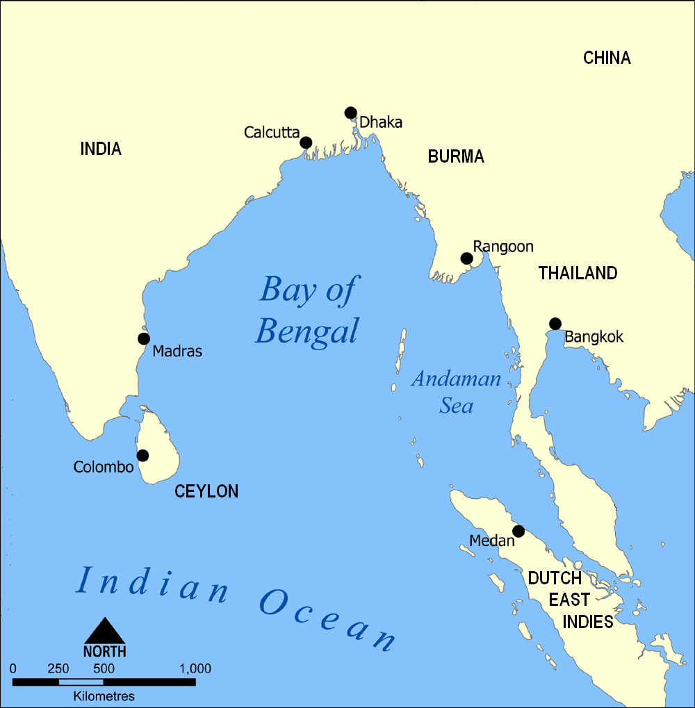
| Description | A map showing the location of the Bay of Bengal and the Andaman Sea in southeast Asia. |
| Date | Original map created by NormanEinstein, September 15, 2005. Ruhrfisch modifications 2009-07 |
| Source | File:Bay of Bengal map.png |
| Author | User:NormanEinstein made the original map, User:Ruhrfisch removed modern state borders, two cities, and changed three country names so it is suitable for 19th century articles. |
| Permission (Reusing this file) |
GFDL, CC-by-SA |
| Other versions |
Original map is  |
I, the copyright holder of this work, hereby publish it under the following licenses:

|
Permission is granted to copy, distribute and/or modify this document under the terms of the GNU Free Documentation License, Version 1.2 or any later version published by the Free Software Foundation; with no Invariant Sections, no Front-Cover Texts, and no Back-Cover Texts. A copy of the license is included in the section entitled GNU Free Documentation License. |
| This file is licensed under the Creative Commons Attribution-Share Alike 3.0 Unported license. | ||
| ||
| This licensing tag was added to this file as part of the GFDL licensing update. |
You may select the license of your choice.
File history
Click on a date/time to view the file as it appeared at that time.
| Date/Time | Thumbnail | Dimensions | User | Comment | |
|---|---|---|---|---|---|
| current | 18:52, 26 July 2009 | | 1,000 × 1,019 (204 KB) | Ruhrfisch | Whoops, uploaded original map before - this is the modified version. Sorry |
| 18:51, 26 July 2009 |  | 1,000 × 1,019 (342 KB) | Ruhrfisch | {{Information |Description= A map showing the location of the Bay of Bengal and the Andaman Sea in southeast Asia. |Source= File:Bay of Bengal map.png |Date= Original map created by NormanEinstein, September 15, 2005. Ruhrfisch modifications 2009-07 |
File usage
The following pages on the English Wikipedia use this file (pages on other projects are not listed):
Global file usage
The following other wikis use this file:
- Usage on id.wikipedia.org
- Usage on it.wikipedia.org
- Usage on ja.wikipedia.org
- Usage on ml.wikipedia.org
- Usage on www.wikidata.org