
Castlewood, South Dakota
Castlewood, South Dakota | |
|---|---|
 The M. O. Hanson Building in Castlewood, July 2013 | |
| Motto: "A Small Town With A Big Heart" | |
 Location in Hamlin County and the state of South Dakota | |
| Coordinates: 44°43′27″N 97°01′51″W / 44.72417°N 97.03083°W | |
| Country | United States |
| State | South Dakota |
| County | Hamlin |
| Founded | 1881 |
| Government | |
| • Mayor | Brian Ries |
| Area | |
| • Town | 1.15 sq mi (2.98 km2) |
| • Land | 1.15 sq mi (2.98 km2) |
| • Water | 0.00 sq mi (0.00 km2) |
| Elevation | 1,686 ft (514 m) |
| Population | |
| • Town | 698 |
| • Estimate (2022)[4] | 707 |
| • Density | 615/sq mi (237.3/km2) |
| • Metro | 35,073 |
| Time zone | UTC–6 (Central (CST)) |
| • Summer (DST) | UTC–5 (CDT) |
| ZIP Code | 57223 |
| Area code | 605 |
| FIPS code | 46-10500 |
| GNIS feature ID | 1267313[2] |
| Sales tax | 6.2%[5] |
| Website | castlewoodcity.com |
Castlewood is a city in Hamlin County, South Dakota, United States. It is part of the Watertown, South Dakota Micropolitan Statistical Area. The population was 698 at the 2020 census.[3] and was estimated to be 707 in 2022.[4]
History
Castlewood was platted in 1881 when the railroad was extended to that point.[6] The city was named Castlewood after a place mentioned in the 1857 novel The Virginians by William Makepeace Thackeray.[6] A post office has been in operation in Castlewood since September 27, 1882.[7]
A destructive EF2 tornado hit the town on May 12, 2022, destroying several structures, damaging homes, and injuring one person.[8]
Geography
Castlewood is located along the Big Sioux River.[9]
According to the United States Census Bureau, the city has a total area of 1.15 square miles (2.98 km2), all land.[1]
Climate
Castlewood has a dry-winter humid continental climate (Köppen Dwb), with four distinct seasons and a high seasonal temperature variation. The winters are long and harsh, with an annual average extreme minimum temperature of -28.1 °F (-33.4 °C), placing it within the 4a USDA Hardiness Zone (-30°F to -25°F) or (-34.4°C to -31.7°C).[10] Summers are warm, with an average temperature of 69.4 °F (20.8 °C) in July, and experience a high level of precipitation compared to the dry winters.
| Climate data for Castlewood, South Dakota, 1991–2020 normals, 1893-2023 extremes: 1685ft (514m) | |||||||||||||
|---|---|---|---|---|---|---|---|---|---|---|---|---|---|
| Month | Jan | Feb | Mar | Apr | May | Jun | Jul | Aug | Sep | Oct | Nov | Dec | Year |
| Record high °F (°C) | 65 (18) |
67 (19) |
84 (29) |
97 (36) |
106 (41) |
108 (42) |
109 (43) |
105 (41) |
103 (39) |
91 (33) |
79 (26) |
71 (22) |
109 (43) |
| Mean maximum °F (°C) | 44.0 (6.7) |
48.9 (9.4) |
64.0 (17.8) |
80.2 (26.8) |
86.1 (30.1) |
91.0 (32.8) |
94.5 (34.7) |
92.4 (33.6) |
87.6 (30.9) |
79.7 (26.5) |
62.4 (16.9) |
44.4 (6.9) |
95.8 (35.4) |
| Mean daily maximum °F (°C) | 20.4 (−6.4) |
25.5 (−3.6) |
37.9 (3.3) |
52.6 (11.4) |
65.4 (18.6) |
75.9 (24.4) |
80.6 (27.0) |
78.8 (26.0) |
70.9 (21.6) |
56.3 (13.5) |
39.1 (3.9) |
25.4 (−3.7) |
52.4 (11.3) |
| Daily mean °F (°C) | 11.0 (−11.7) |
15.1 (−9.4) |
28.1 (−2.2) |
41.4 (5.2) |
54.3 (12.4) |
64.9 (18.3) |
69.4 (20.8) |
67.3 (19.6) |
58.5 (14.7) |
44.5 (6.9) |
29.5 (−1.4) |
16.7 (−8.5) |
41.7 (5.4) |
| Mean daily minimum °F (°C) | 1.7 (−16.8) |
4.8 (−15.1) |
18.3 (−7.6) |
30.3 (−0.9) |
43.2 (6.2) |
53.8 (12.1) |
58.2 (14.6) |
55.7 (13.2) |
46.1 (7.8) |
32.7 (0.4) |
19.9 (−6.7) |
8.1 (−13.3) |
31.1 (−0.5) |
| Mean minimum °F (°C) | −22.7 (−30.4) |
−20.1 (−28.9) |
−5.9 (−21.1) |
15.3 (−9.3) |
27.6 (−2.4) |
39.8 (4.3) |
45.3 (7.4) |
41.2 (5.1) |
28.4 (−2.0) |
15.5 (−9.2) |
−0.2 (−17.9) |
−16.3 (−26.8) |
−28.1 (−33.4) |
| Record low °F (°C) | −41 (−41) |
−44 (−42) |
−29 (−34) |
−5 (−21) |
12 (−11) |
24 (−4) |
33 (1) |
30 (−1) |
9 (−13) |
−4 (−20) |
−23 (−31) |
−37 (−38) |
−44 (−42) |
| Average precipitation inches (mm) | 0.52 (13) |
0.63 (16) |
1.18 (30) |
2.06 (52) |
3.87 (98) |
3.98 (101) |
3.45 (88) |
2.82 (72) |
3.06 (78) |
1.93 (49) |
0.76 (19) |
0.52 (13) |
24.78 (629) |
| Average snowfall inches (cm) | 4.6 (12) |
4.9 (12) |
5.4 (14) |
2.6 (6.6) |
0.0 (0.0) |
0.0 (0.0) |
0.0 (0.0) |
0.0 (0.0) |
0.0 (0.0) |
0.0 (0.0) |
3.2 (8.1) |
7.4 (19) |
28.1 (71.7) |
| Average precipitation days (≥ 0.01 in) | 3.8 | 3.4 | 4.4 | 7.1 | 9.5 | 9.9 | 8.1 | 7.3 | 6.6 | 5.5 | 3.3 | 4.9 | 73.8 |
| Average snowy days (≥ 0.1 in) | 3.8 | 2.7 | 2.2 | 0.8 | 0.0 | 0.0 | 0.0 | 0.0 | 0.0 | 0.1 | 2.2 | 3.6 | 15.4 |
| Source 1: NOAA (1981-2010 snowfall)[11][12] | |||||||||||||
| Source 2: XMACIS2 (temp records & monthly max/mins)[13] | |||||||||||||
Demographics
| Census | Pop. | Note | %± |
|---|---|---|---|
| 1900 | 430 | — | |
| 1910 | 594 | 38.1% | |
| 1920 | 582 | −2.0% | |
| 1930 | 500 | −14.1% | |
| 1940 | 493 | −1.4% | |
| 1950 | 498 | 1.0% | |
| 1960 | 500 | 0.4% | |
| 1970 | 523 | 4.6% | |
| 1980 | 557 | 6.5% | |
| 1990 | 549 | −1.4% | |
| 2000 | 666 | 21.3% | |
| 2010 | 627 | −5.9% | |
| 2020 | 698 | 11.3% | |
| 2022 (est.) | 707 | [4] | 1.3% |
| U.S. Decennial Census[14] 2020 Census[3] | |||
2020 census
As of the 2020 census, there were 698 people and 270 households, and 180 families residing in the town.[15] There were 296 housing units.
2010 census
As of the 2010 census, there were 627 people in 260 households, including 158 families, in the city. The population density was 545.2 inhabitants per square mile (210.5/km2). There were 292 housing units at an average density of 253.9 per square mile (98.0/km2). The racial makeup of the city was 96.5% White, 0.5% African American, 0.5% Native American, 0.2% Asian, 1.4% from other races, and 1.0% from two or more races. Hispanic or Latino of any race were 1.8%.
Of the 260 households 35.4% had children under the age of 18 living with them, 50.4% were married couples living together, 6.9% had a female householder with no husband present, 3.5% had a male householder with no wife present, and 39.2% were non-families. 33.5% of households were one person and 17.6% were one person aged 65 or older. The average household size was 2.41 and the average family size was 3.16.
The median age was 36.2 years. 28.2% of residents were under the age of 18; 7.4% were between the ages of 18 and 24; 26% were from 25 to 44; 24% were from 45 to 64; and 14.5% were 65 or older. The gender makeup of the city was 50.2% male and 49.8% female.
2000 census
As of the 2000 census, there were 666 people in 253 households, including 185 families, in the city. The population density was 585.9 inhabitants per square mile (226.2/km2). There were 265 housing units at an average density of 233.1 per square mile (90.0/km2). The racial makeup of the city was 98.95% White, 0.45% Native American, and 0.60% from two or more races. Hispanic or Latino of any race were 0.30%. 38.1% were of German, 18.4% Norwegian, 9.9% Dutch, 6.8% American, 6.4% Irish and 5.6% English ancestry.
Of the 253 households 40.3% had children under the age of 18 living with them, 60.5% were married couples living together, 7.9% had a female householder with no husband present, and 26.5% were non-families. 24.1% of households were one person and 14.2% were one person aged 65 or older. The average household size was 2.57 and the average family size was 3.06.
The age distribution was 28.5% under the age of 18, 8.1% from 18 to 24, 26.6% from 25 to 44, 20.6% from 45 to 64, and 16.2% 65 or older. The median age was 35 years. For every 100 females, there were 94.7 males. For every 100 females age 18 and over, there were 91.9 males.
The median income was $36,607 and the median income for a family was $41,806. Males had a median income of $29,688 versus $20,750 for females. The per capita income for the city was $17,682. About 7.7% of families and 7.1% of the population were below the poverty line, including 12.0% of those under age 18 and 6.7% of those age 65 or over.
Notable people
- Marv Heemeyer; born here, and went on a bulldozer rampage/suicide in Colorado
- Kristi Noem – Governor of South Dakota (2019–present) and U.S. Representative (2011–2019)
See also
References
- ^ a b "2023 U.S. Gazetteer Files". United States Census Bureau. Retrieved February 27, 2024.
- ^ a b U.S. Geological Survey Geographic Names Information System: Castlewood, South Dakota
- ^ a b c "Explore Census Data". United States Census Bureau. Retrieved February 27, 2024.
- ^ a b c "City and Town Population Totals: 2020–2022". United States Census Bureau. February 27, 2024. Retrieved February 27, 2024.
- ^ "Castlewood (SD) sales tax rate". Retrieved February 27, 2024.
- ^ a b Chicago and North Western Railway Company (1908). A History of the Origin of the Place Names Connected with the Chicago & North Western and Chicago, St. Paul, Minneapolis & Omaha Railways. p. 53.
- ^ "Hamlin County". Jim Forte Postal History. Retrieved February 28, 2015.
- ^ NWS Damage Survey for 05/12/22 Tornado Event (Report). Iowa Environmental Mesonet. May 13, 2022. Retrieved May 13, 2022.
{{cite report}}: Unknown parameter|agency=ignored (help) - ^ DeLorme (2001), South Dakota Atlas & Gazetteer, Yarmouth, Maine: DeLorme ISBN 0-89933-330-3
- ^ "South Dakota Hardiness Zones Map - 2023". Plantmaps.com. Retrieved January 15, 2024.
- ^ "Castlewood, South Dakota 1991-2020 Monthly Normals". Retrieved January 15, 2024.
- ^ "Castlewood, South Dakota 1981-2010 Monthly Normals". Retrieved January 15, 2024.
- ^ "xmACIS". National Oceanic and Atmospheric Administration. Retrieved January 15, 2024.
- ^ "Census of Population and Housing". United States Census Bureau. Retrieved June 4, 2015.
- ^ "US Census Bureau, Table P16: Household Type". United States Census Bureau. Retrieved February 27, 2024.
External links
Municipalities and communities of Hamlin County, South Dakota, United States | ||
|---|---|---|
| Cities | 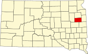 | |
| Towns | ||
| CDP | ||
| Other communities | ||
| Footnotes | ‡This populated place also has portions in an adjacent county or counties | |