Beithabbak
This article needs additional citations for verification. (January 2016) |
Beithabbak
بيت حباق | |
|---|---|
 | |
| Coordinates: 34°9′50″N 35°42′31″E / 34.16389°N 35.70861°E | |
| Country | |
| Governorate | Keserwan-Jbeil |
| District | Byblos District |
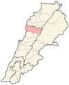
Beithabbak (Arabic: بيت حباق) is a small village in the district of Byblos in Lebanon. It is located on a small hill, 11 kilometres (6.8 mi) northwest from Byblos at an altitude of 540 metres (1,770 ft), just above Amsheet and Gharfine and before Abeidat.
History
This section may relate to a different subject or has undue weight on an aspect of the subject. (February 2016) |
The family's presence in Beithabbak dates from early times when their ancestors and their fathers established themselves. Six main families in the village of Abidaoud,[1] Ferjan, Akl, Osabios and Jbeili. The Sakr family recently immigrated from Ghalboun village. The Hobeika, Habbaki family and Azar families left Beithabbak sometimes in the early 17th century.
Other names include Beit Habbak, Habbaki, Habbak, Hebbaki, Hebbak, Hibbak, Hibbaki, Hbaika, Hbeiki, Hbeikati, Habbeikat, Hbbak, Hobeika.
Demography
There are 310 inhabitants in the village. The inhabitants are Maronite Christians. Some part of the population has emigrated to Latin America Brazil, France, Canada, Switzerland, Lithuania and United States. Many are currently resident in USA, Canada and Brazil.
Schools
There is one school in the village, the Missionary Sisters of the Very Holy Sacrament school.[2]
Churches

There are Six chapels in the village:
- Saint Antonio, a small grotto chapel located inside cliff monastery in the eastern part of the village.
- Saint Mary, a small main church which can host 80 persons, located in the central square of the village.
- Saint Sarkis a small chapel near village Christian events hall and cemetery.
- Missionary Sisters of the Very Holy Sacrament Chapel located inside the school.
- Saint Simon, a small grotto chapel located between Beithabbak and Abaidat inside cliff monastery
- Akl family small private chapel built earlier by their member Bishop Akl.
The chapels of Saint Antonio and Saint Simon dates from the beginning of the 19th century. One can notice its small entrance doors which are typical of churches in the area. These were designed to prevent Ottoman cavaliers from bursting inside with their horses.
The priest responsible for the Beithabbak Churches is newly assigned Father by Bishop of Byblos, based in Amsheet.
Climate
Beithabak has a unique Mediterranean climate characterized by a hot and virtually rain-free very long summer of eight-month, pleasant green fall and spring, and cool, rainy winter. August is the hottest month of the year while January and February are the coldest. The average annual rainfall is approximately 900 millimeters, virtually all of which falls in winter, autumn and spring. Much of the rain in autumn and spring falls on a limited number of days in heavy downpours. In winter, however, the rain is more evenly spread over many days. Summer receives very little rainfall most of the years none. Snow in Beithabak is very rare and usually occurs without accumulation.
Beithabak Club
Beithabak Club is a sport, social and cultural club offering recreational sports facilities to its members: shooting, basketball, soccer, volleyball, table tennis, camping and a gym. It is mostly active during summer season when it hosts national and regional tournaments. The town is the site of the annual village small festival, held in the church square it raises funds for community renovation and other needs.
Geography
Beithabak occupies a hill, 500–650 meters above sea level, which gives the town views of the part of Lebanon's Mediterranean coast, the lower mountain surrounding range the valley corridors in between all the way to the horizon of the Mediterranean Sea. Very remote location between the Holy Saints pilgrimage sites of Lehfed, Anaya and the city of Byblos, overseeing the lower mountain range and the upper mountain range including the ancient Phoenician waterway to the south of the village as the ancient highway transporting the cedar wood from the Jaje ancient cedar park to Byblos port.
See also
- Beit Mary
- Beitedine
- Bethsaida
- Beithlehem
- New Testament places associated with Jesus
- Sea of Galilee Boat
References
- ^ "User-submitted surname Abidaoud - Behind the Name".
- ^ "Missionary Sisters of the Very Holy Sacrament". Archived from the original on 2016-01-01. Retrieved 2016-01-09.


