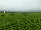
Baisha Li Autonomous County
Baisha County
白沙县 Paksa | |
|---|---|
| 白沙黎族自治县 Baisha Li Autonomous County | |
 | |
| Coordinates: 19°13′37″N 109°27′47″E / 19.22694°N 109.46306°E | |
| Country | People's Republic of China |
| Province | Hainan |
| County seat | Yacha |
| Area | |
| • Total | 2,177 km2 (841 sq mi) |
| Population (1999)[1] | 176,377 |
| Time zone | UTC+8 (China standard time) |
| Postal code | 572800 |
| Website | baisha |
Baisha Li Autonomous County (Chinese: s 白沙黎族自治县), p Báishā Lízú Zìzhìxiàn) is one of 6 autonomous counties of Hainan, China. In 1999 its population was 176,377 people, largely made up of the Li people.
Baisha County was established in 1935, alongside Baoting County and Ledong County. In 1958, this county was briefly merged into Dongfang County before reestablished three years later. On 20 November 1987, the State Council ratified this county as an autonomous county for Li people, and on 30 December the official establishment ceremony was held.[2][3]
Administrative division
Baisha County is divided into:[4][5]
- 4 Towns (镇): Yacha (牙叉镇), Qifang (七坊镇), Bangxi (邦溪镇), Da'an (打安镇).
- 7 Townships (乡):Xishui Township (细水乡), Yuanmen Township (元门乡), Nankai Township (南开乡), Fulong Township (阜龙乡), Qingsong Township (青松乡), Jinpo Township (金波乡), Rongbang Township (荣邦乡).
- 9 Township-level Farm Areas (农场)
Demography
| Ethnic group | Percentage |
|---|---|
| Hlai | 60.1% |
| Han | 36.7% |
| Zhuang | 1.5% |
| Miao | 1% |
| others | 0.7% |
The main spoken languages in this county are Hlai, Hainanese, and Mandarin.
Geography
Baisha County are mostly mountainous forests which covered 83.47% of the county. The mountainous areas occupy around 73.1% of the county area, seconded by hilly areas with 19.1%, and the rest is plains with 7.7%. The highest mountain in the county is Yinggeling Mountain (1812 m above sea level), which also Hainan's second highest mountain after Wuzhi Mountain. The source of rivers like Nandu River, Changhua River, Zhubo River, and Shilu River, are found in this county.[2][3]
Climate
Baisha has a tropical savanna climate (Köppen Aw).It borders the subtropical monsoon climate (Köppen Cwa)
| Climate data for Baisha (1991–2020 normals, extremes 1981–2010) | |||||||||||||
|---|---|---|---|---|---|---|---|---|---|---|---|---|---|
| Month | Jan | Feb | Mar | Apr | May | Jun | Jul | Aug | Sep | Oct | Nov | Dec | Year |
| Record high °C (°F) | 34.2 (93.6) |
37.4 (99.3) |
38.1 (100.6) |
39.0 (102.2) |
37.8 (100.0) |
36.6 (97.9) |
37.2 (99.0) |
36.5 (97.7) |
34.0 (93.2) |
34.4 (93.9) |
34.4 (93.9) |
32.3 (90.1) |
39.0 (102.2) |
| Mean daily maximum °C (°F) | 23.5 (74.3) |
25.8 (78.4) |
29.5 (85.1) |
32.0 (89.6) |
33.2 (91.8) |
33.7 (92.7) |
33.3 (91.9) |
32.5 (90.5) |
31.1 (88.0) |
29.0 (84.2) |
26.5 (79.7) |
23.3 (73.9) |
29.5 (85.0) |
| Daily mean °C (°F) | 17.8 (64.0) |
19.6 (67.3) |
22.8 (73.0) |
25.5 (77.9) |
27.0 (80.6) |
28.1 (82.6) |
27.6 (81.7) |
26.8 (80.2) |
25.7 (78.3) |
23.9 (75.0) |
21.5 (70.7) |
18.5 (65.3) |
23.7 (74.7) |
| Mean daily minimum °C (°F) | 14.3 (57.7) |
15.6 (60.1) |
18.5 (65.3) |
21.4 (70.5) |
23.3 (73.9) |
24.4 (75.9) |
24.0 (75.2) |
23.5 (74.3) |
22.7 (72.9) |
20.8 (69.4) |
18.4 (65.1) |
15.5 (59.9) |
20.2 (68.4) |
| Record low °C (°F) | 1.8 (35.2) |
6.9 (44.4) |
10.9 (51.6) |
14.2 (57.6) |
17.7 (63.9) |
19.6 (67.3) |
21.1 (70.0) |
19.2 (66.6) |
16.5 (61.7) |
10.8 (51.4) |
9.3 (48.7) |
0.4 (32.7) |
0.4 (32.7) |
| Average precipitation mm (inches) | 15.6 (0.61) |
16.1 (0.63) |
40.8 (1.61) |
124.2 (4.89) |
263.8 (10.39) |
190.7 (7.51) |
256.7 (10.11) |
346.2 (13.63) |
303.3 (11.94) |
236.4 (9.31) |
90.6 (3.57) |
42.7 (1.68) |
1,927.1 (75.88) |
| Average precipitation days (≥ 0.1 mm) | 9.6 | 8.0 | 8.9 | 12.1 | 17.9 | 15.2 | 18.3 | 20.2 | 19.1 | 14.1 | 11.2 | 10.5 | 165.1 |
| Average relative humidity (%) | 84 | 81 | 78 | 78 | 80 | 78 | 80 | 84 | 86 | 85 | 85 | 85 | 82 |
| Mean monthly sunshine hours | 132.9 | 141.6 | 181.8 | 195.8 | 212.6 | 215.5 | 221.3 | 198.0 | 169.1 | 167.5 | 139.2 | 111.7 | 2,087 |
| Percent possible sunshine | 39 | 44 | 49 | 52 | 53 | 54 | 55 | 50 | 46 | 47 | 42 | 33 | 47 |
| Source: China Meteorological Administration[7][8] | |||||||||||||
Transportation
Railway
Highway
Gallery
 |
 |
 |
 |
See also
References
- ^ Lex, Berman (2017). "China Population by County (1999)". Harvard Dataverse. 1 (CHGIS Dataverse). doi:10.7910/DVN/EOH3FV. Retrieved 5 August 2021.
- ^ a b "白沙黎族自治县简介". 白沙黎族自治县人民政府网 (in Chinese). Retrieved 5 August 2021.
- ^ a b "历史沿革". 白沙黎族自治县人民政府网 (in Chinese). Retrieved 5 August 2021.
- ^ "2020年统计用区划代码和城乡划分代码:白沙黎族自治县". 中华人民共和国国家统计局 (in Chinese). Retrieved 5 August 2021.
- ^ a b "白沙县概况". 行政区划网 (in Chinese). 6 August 2009. Retrieved 5 August 2021.
- ^ "行政区划和人口民族". 白沙黎族自治县人民政府网 (in Chinese). Retrieved 5 August 2021.
- ^ 中国气象数据网 – WeatherBk Data (in Simplified Chinese). China Meteorological Administration. Retrieved 17 June 2023.
- ^ 中国气象数据网 (in Simplified Chinese). China Meteorological Administration. Retrieved 17 June 2023.

